
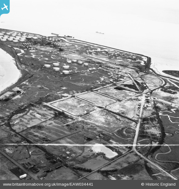
EAW034441 ENGLAND (1951). Part of the Coryton Oil Refinery under construction, Coryton, 1951. This image has been produced from a print marked by Aerofilms Ltd for photo editing.
© Copyright OpenStreetMap contributors and licensed by the OpenStreetMap Foundation. 2026. Cartography is licensed as CC BY-SA.
Nearby Images (48)
EAW034441

EAW042270

EAW048368

EAW039882

EAW042271

EAW035777

EAW041998

EAW048374

EAW048595

EAW048590

EAW039885

EAW047437

EAW034402

EAW045722

EAW047436

EAW048375

EAW042276

EAW048376

EAW039896

EAW048104

EAW051373

EAW043884

EAW048103

EAW045731

EAW048373

EAW045727

EAW042284

EAW035775

EAW048600

EAW048093

EAW048094

EAW048594

EAW048372

EAW047438

EAW045726

EAW042275

EAW045721

EAW043880

EAW051372

EAW048105

EAW042285

EAW034442

EAW045729

EAW042273

EAW053085

EAW048100

EAW045728

EAW039897

Details
| Title | [EAW034441] Part of the Coryton Oil Refinery under construction, Coryton, 1951. This image has been produced from a print marked by Aerofilms Ltd for photo editing. |
| Reference | EAW034441 |
| Date | 12-January-1951 |
| Link | |
| Place name | CORYTON |
| Parish | |
| District | |
| Country | ENGLAND |
| Easting / Northing | 574842, 182546 |
| Longitude / Latitude | 0.52008569050357, 51.514260432611 |
| National Grid Reference | TQ748825 |
Pins
Be the first to add a comment to this image!