
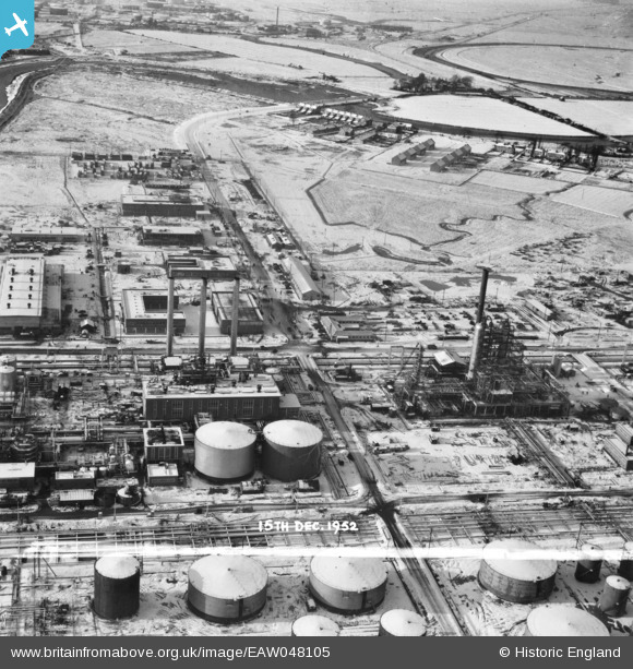
EAW048105 ENGLAND (1952). Part of the Coryton Oil Refinery under construction, Coryton, 1952. This image was marked by Aerofilms Ltd for photo editing.
© Copyright OpenStreetMap contributors and licensed by the OpenStreetMap Foundation. 2026. Cartography is licensed as CC BY-SA.
Nearby Images (48)
EAW048105

EAW051372

EAW045729

EAW045726

EAW045728

EAW045721

EAW045731

EAW048373

EAW042273

EAW053085

EAW048100

EAW048600

EAW051373

EAW048094

EAW034410

EAW048375

EAW045722

EAW035776

EAW034439

EAW042277

EAW024609
, Coryton, from the east, 1949. This image has been produced from a damaged negative.")
EAW034438

EAW043885

EAW039885

EAW048590

EAW034407

EAW034440

EAW042274

EAW043884

EAW034404

EAW047423

EAW039896

EAW039894

EAW035780

EAW035779

EAW039886

EAW048093

EAW048597

EAW048598

EAW048086

EAW035783

EAW047427

EAW045727

EAW048376

EAW034442

EAW047421

EAW003538

EAW048092

Details
| Title | [EAW048105] Part of the Coryton Oil Refinery under construction, Coryton, 1952. This image was marked by Aerofilms Ltd for photo editing. |
| Reference | EAW048105 |
| Date | 15-December-1952 |
| Link | |
| Place name | CORYTON |
| Parish | |
| District | |
| Country | ENGLAND |
| Easting / Northing | 574681, 182384 |
| Longitude / Latitude | 0.51768724547893, 51.512854864424 |
| National Grid Reference | TQ747824 |
Pins
Be the first to add a comment to this image!