
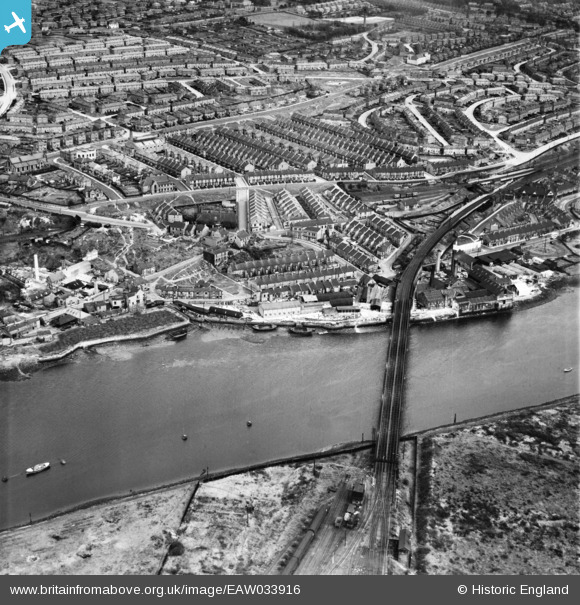
EAW033916 ENGLAND (1950). Scotswood and the railway viaduct, Scotswood, 1950
© Copyright OpenStreetMap contributors and licensed by the OpenStreetMap Foundation. 2026. Cartography is licensed as CC BY-SA.
Nearby Images (11)
EAW033916

EAW033910
, Scotswood, 1950. This image has been produced from a damaged negative.")
EAW033918

EAW033915

EAW033913

EAW033914

EAW033912
, Scotswood, 1950. This image has been produced from a damaged negative.")
EAW033917

EAW033911

EAW033909
, Blaydon, 1950. This image has been produced from a damaged negative.")
EAW033907

Details
| Title | [EAW033916] Scotswood and the railway viaduct, Scotswood, 1950 |
| Reference | EAW033916 |
| Date | 19-October-1950 |
| Link | |
| Place name | SCOTSWOOD |
| Parish | |
| District | |
| Country | ENGLAND |
| Easting / Northing | 419786, 563899 |
| Longitude / Latitude | -1.6908976493043, 54.969242807834 |
| National Grid Reference | NZ198639 |
Pins

Paul |
Thursday 26th of March 2026 01:02:42 PM | |
|
Paul |
Friday 20th of March 2026 02:43:28 PM | |
|
willhelm |
Sunday 23rd of April 2023 12:20:23 AM | |
|
willhelm |
Sunday 23rd of April 2023 12:11:38 AM | |
|
willhelm |
Sunday 23rd of April 2023 12:08:49 AM | |
|
willhelm |
Sunday 23rd of April 2023 12:06:47 AM | |
|
willhelm |
Sunday 23rd of April 2023 12:05:23 AM | |
|
willhelm |
Sunday 23rd of April 2023 12:04:02 AM | |
|
AndyC |
Monday 6th of December 2021 02:10:13 PM | |
|
AndyC |
Saturday 4th of December 2021 05:26:01 PM | |
|
drifton |
Friday 3rd of April 2020 05:40:27 PM |
