
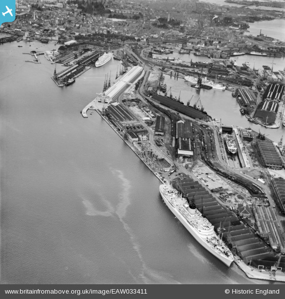
EAW033411 ENGLAND (1950). The Docks, Southampton, 1950
© Copyright OpenStreetMap contributors and licensed by the OpenStreetMap Foundation. 2026. Cartography is licensed as CC BY-SA.
Nearby Images (18)
EAW033411

EAW001345

EPW032346

EAW008809

EAW033432

EAW001348

EPW037407

EPW037412

EPW009067

EPW009064

EAW001349

EPW041071

EPW039724

EAW001369
 in Ocean Dock, Southampton, 1946")
EAW033414

EAW001346

EPW037408

EAW033409

Details
| Title | [EAW033411] The Docks, Southampton, 1950 |
| Reference | EAW033411 |
| Date | 10-October-1950 |
| Link | |
| Place name | SOUTHAMPTON |
| Parish | |
| District | |
| Country | ENGLAND |
| Easting / Northing | 442490, 109880 |
| Longitude / Latitude | -1.3958822097428, 50.886289243728 |
| National Grid Reference | SU425099 |
Pins

Sailor Steve |
Wednesday 30th of December 2015 11:46:52 PM | |
|
Sailor Steve |
Wednesday 30th of December 2015 11:45:10 PM |