
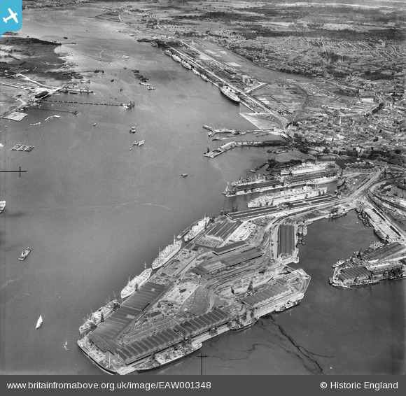
EAW001348 ENGLAND (1946). The Docks, Southampton, from the south-east, 1946
© Copyright OpenStreetMap contributors and licensed by the OpenStreetMap Foundation. 2026. Cartography is licensed as CC BY-SA.
Nearby Images (19)
EAW001348

EAW001349

EPW037407

EAW001346

EAW033411

EPW037408

EPW032343

EAW008809

EAW001369
 in Ocean Dock, Southampton, 1946")
EPW032346

EAW001345

EAW046509

EPW009070

EPW037412

EAW033432

EPW039724

EPW009067

EPW041071

EPW041070

Details
| Title | [EAW001348] The Docks, Southampton, from the south-east, 1946 |
| Reference | EAW001348 |
| Date | 28-June-1946 |
| Link | |
| Place name | SOUTHAMPTON |
| Parish | |
| District | |
| Country | ENGLAND |
| Easting / Northing | 442430, 110017 |
| Longitude / Latitude | -1.3967193191571, 50.887525689474 |
| National Grid Reference | SU424100 |
Pins

Jessie Russel |
Monday 7th of July 2025 10:30:38 PM | |

Sparky |
Saturday 18th of November 2017 08:24:03 AM | |
|
ken |
Friday 17th of July 2015 10:40:27 AM | |
|
Graham Yaxley |
Monday 5th of January 2015 12:17:16 AM | |
|
john g |
Saturday 25th of October 2014 10:41:58 AM | |
|
chainbull |
Sunday 3rd of August 2014 08:23:40 PM |