
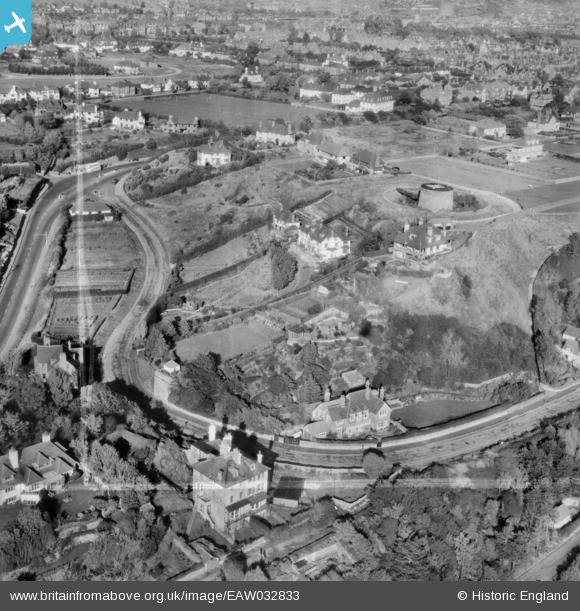
EAW032833 ENGLAND (1950). Martello Tower no. 4, Radnor Cliff Crescent and environs, Folkestone, 1950. This image was marked by Aerofilms Ltd for photo editing.
© Copyright OpenStreetMap contributors and licensed by the OpenStreetMap Foundation. 2026. Cartography is licensed as CC BY-SA.
Nearby Images (14)
EAW032833

EAW032835

EAW032834

EAW032836

EPW000585

EAW032832

EPW026113

EAW002376

EPW035412

EAW002377

EPW026117

EAW002858

EPW019045

EAW002859

Details
| Title | [EAW032833] Martello Tower no. 4, Radnor Cliff Crescent and environs, Folkestone, 1950. This image was marked by Aerofilms Ltd for photo editing. |
| Reference | EAW032833 |
| Date | 3-October-1950 |
| Link | |
| Place name | FOLKESTONE |
| Parish | FOLKESTONE |
| District | |
| Country | ENGLAND |
| Easting / Northing | 621055, 135358 |
| Longitude / Latitude | 1.1559803792028, 51.074369333194 |
| National Grid Reference | TR211354 |
Pins
Be the first to add a comment to this image!