
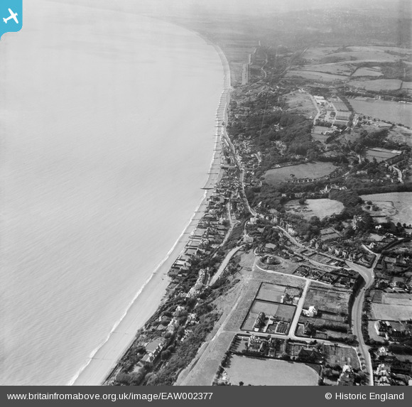
EAW002377 ENGLAND (1946). Sandgate Hill and environs, Folkestone, from the east, 1946
© Copyright OpenStreetMap contributors and licensed by the OpenStreetMap Foundation. 2026. Cartography is licensed as CC BY-SA.
Nearby Images (14)
EAW002377

EPW035412

EAW002376

EPW019045

EAW032832

EPW026113

EAW002860

EAW032835

EAW032834

EAW032836

EPW042871

EAW032833

EAW002859

EAW002858

Details
| Title | [EAW002377] Sandgate Hill and environs, Folkestone, from the east, 1946 |
| Reference | EAW002377 |
| Date | 9-September-1946 |
| Link | |
| Place name | FOLKESTONE |
| Parish | FOLKESTONE |
| District | |
| Country | ENGLAND |
| Easting / Northing | 621252, 135342 |
| Longitude / Latitude | 1.1587785631369, 51.07414974732 |
| National Grid Reference | TR213353 |
Pins

redmist |
Sunday 16th of February 2025 10:42:58 AM | |
|
redmist |
Sunday 16th of February 2025 10:41:50 AM | |
|
redmist |
Sunday 16th of February 2025 10:40:57 AM | |
|
redmist |
Sunday 16th of February 2025 10:39:50 AM |