
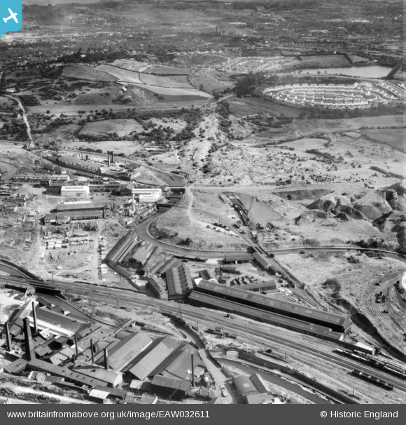
EAW032611 ENGLAND (1950). Hill and Smith Ltd Brierleyhill Iron Works and environs, Hart's Hill, 1950
© Copyright OpenStreetMap contributors and licensed by the OpenStreetMap Foundation. 2026. Cartography is licensed as CC BY-SA.
Nearby Images (8)
EAW032611

EAW032603

EAW032608

EAW032604

EAW032610

EAW032605

EAW032606

EAW032600

Details
| Title | [EAW032611] Hill and Smith Ltd Brierleyhill Iron Works and environs, Hart's Hill, 1950 |
| Reference | EAW032611 |
| Date | 18-September-1950 |
| Link | |
| Place name | HART'S HILL |
| Parish | |
| District | |
| Country | ENGLAND |
| Easting / Northing | 392782, 288086 |
| Longitude / Latitude | -2.1063166803523, 52.490271819026 |
| National Grid Reference | SO928881 |
Pins

Steve |
Wednesday 25th of May 2022 01:55:47 PM | |

black country history hunter |
Friday 29th of June 2018 07:41:48 PM | |
|
AndrewGVT |
Monday 6th of July 2015 05:52:41 PM | |
|
AndrewGVT |
Monday 6th of July 2015 05:52:09 PM |