
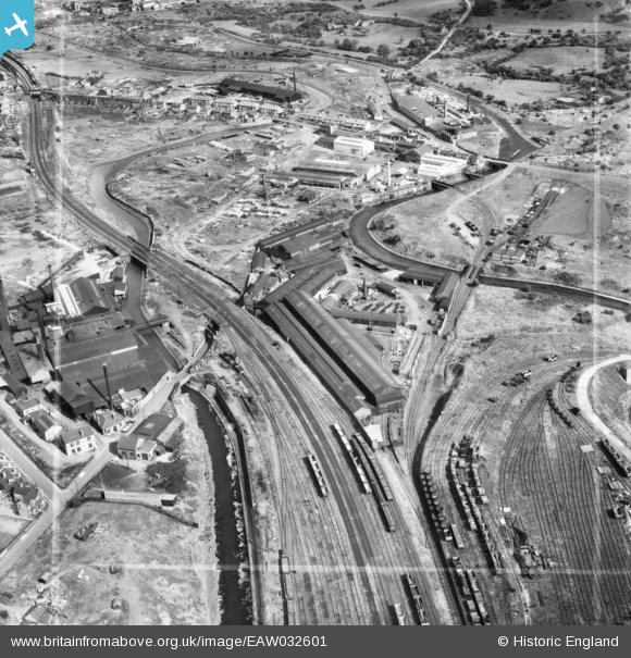
EAW032601 ENGLAND (1950). Hill and Smith Ltd Brierleyhill Iron Works, Hart's Hill, 1950. This image was marked by Aerofilms Ltd for photo editing.
© Copyright OpenStreetMap contributors and licensed by the OpenStreetMap Foundation. 2026. Cartography is licensed as CC BY-SA.
Nearby Images (16)
EAW032601

EAW032599

EAW032609

EAW032607

EAW032602

EAW032598

EAW032606

EAW032605

EAW032600

EAW032604

EAW032610

EPW011859

EAW032603

EAW032608

EAW008348

EAW008345

Details
| Title | [EAW032601] Hill and Smith Ltd Brierleyhill Iron Works, Hart's Hill, 1950. This image was marked by Aerofilms Ltd for photo editing. |
| Reference | EAW032601 |
| Date | 18-September-1950 |
| Link | |
| Place name | HART'S HILL |
| Parish | |
| District | |
| Country | ENGLAND |
| Easting / Northing | 392514, 288091 |
| Longitude / Latitude | -2.1102642593948, 52.490313161305 |
| National Grid Reference | SO925881 |
Pins
Be the first to add a comment to this image!