
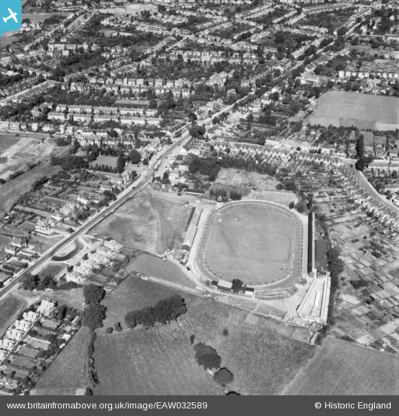
EAW032589 ENGLAND (1950). Kings Heath Greyhound Track and Alcester Road South, Brandwood End, 1950
© Copyright OpenStreetMap contributors and licensed by the OpenStreetMap Foundation. 2026. Cartography is licensed as CC BY-SA.
Nearby Images (13)
EAW032589

EAW032590

EAW032593

EPW027016

EAW032586

EAW032588

EAW032587

EAW032595

EAW032596

EAW032597

EAW032594

EAW032591

EAW032592

Details
| Title | [EAW032589] Kings Heath Greyhound Track and Alcester Road South, Brandwood End, 1950 |
| Reference | EAW032589 |
| Date | 18-September-1950 |
| Link | |
| Place name | BRANDWOOD END |
| Parish | |
| District | |
| Country | ENGLAND |
| Easting / Northing | 407539, 280283 |
| Longitude / Latitude | -1.8891315317885, 52.420110480458 |
| National Grid Reference | SP075803 |
Pins

Neil |
Sunday 31st of October 2021 01:54:41 AM |