
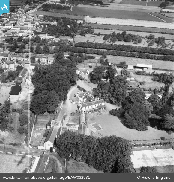
EAW032531 ENGLAND (1950). Hillam Hall, Hillam, 1950. This image was marked by Aerofilms Ltd for photo editing.
© Copyright OpenStreetMap contributors and licensed by the OpenStreetMap Foundation. 2026. Cartography is licensed as CC BY-SA.
Nearby Images (5)
EAW032531

EAW032530

EAW032529

EAW032532

EAW032533

Details
| Title | [EAW032531] Hillam Hall, Hillam, 1950. This image was marked by Aerofilms Ltd for photo editing. |
| Reference | EAW032531 |
| Date | 5-September-1950 |
| Link | |
| Place name | HILLAM |
| Parish | HILLAM |
| District | |
| Country | ENGLAND |
| Easting / Northing | 451014, 428841 |
| Longitude / Latitude | -1.2262360447579, 53.753214296905 |
| National Grid Reference | SE510288 |
Pins

totoro |
Thursday 3rd of July 2014 10:01:03 PM | |
|
totoro |
Thursday 3rd of July 2014 09:59:12 PM | |
|
totoro |
Thursday 3rd of July 2014 09:57:03 PM | |
|
totoro |
Thursday 3rd of July 2014 09:36:34 PM |