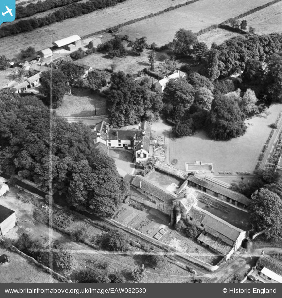
EAW032530 ENGLAND (1950). Hillam Hall, Hillam, 1950. This image was marked by Aerofilms Ltd for photo editing.
© Copyright OpenStreetMap contributors and licensed by the OpenStreetMap Foundation. 2026. Cartography is licensed as CC BY-SA.
Nearby Images (5)
Details
| Title | [EAW032530] Hillam Hall, Hillam, 1950. This image was marked by Aerofilms Ltd for photo editing. |
| Reference | EAW032530 |
| Date | 5-September-1950 |
| Link | |
| Place name | HILLAM |
| Parish | HILLAM |
| District | |
| Country | ENGLAND |
| Easting / Northing | 451036, 428791 |
| Longitude / Latitude | -1.225910652229, 53.75276272967 |
| National Grid Reference | SE510288 |
Pins

totoro |
Thursday 3rd of July 2014 10:01:24 PM | |

totoro |
Thursday 3rd of July 2014 09:59:00 PM | |

totoro |
Thursday 3rd of July 2014 09:56:54 PM | |

totoro |
Thursday 3rd of July 2014 09:36:25 PM |


![[EAW032530] Hillam Hall, Hillam, 1950. This image was marked by Aerofilms Ltd for photo editing.](http://britainfromabove.org.uk/sites/all/libraries/aerofilms-images/public/100x100/EAW/032/EAW032530.jpg)
![[EAW032529] Hillam Hall, Hillam, 1950. This image was marked by Aerofilms Ltd for photo editing.](http://britainfromabove.org.uk/sites/all/libraries/aerofilms-images/public/100x100/EAW/032/EAW032529.jpg)
![[EAW032531] Hillam Hall, Hillam, 1950. This image was marked by Aerofilms Ltd for photo editing.](http://britainfromabove.org.uk/sites/all/libraries/aerofilms-images/public/100x100/EAW/032/EAW032531.jpg)
![[EAW032532] Hillam Hall, the Hillam & Monk Fryston Cricket Ground and the surrounding countryside, Hillam, 1950](http://britainfromabove.org.uk/sites/all/libraries/aerofilms-images/public/100x100/EAW/032/EAW032532.jpg)
![[EAW032533] Hillam Hall, the Hillam & Monk Fryston Cricket Ground and the village, Hillam, 1950. This image was marked by Aerofilms Ltd for photo editing.](http://britainfromabove.org.uk/sites/all/libraries/aerofilms-images/public/100x100/EAW/032/EAW032533.jpg)