
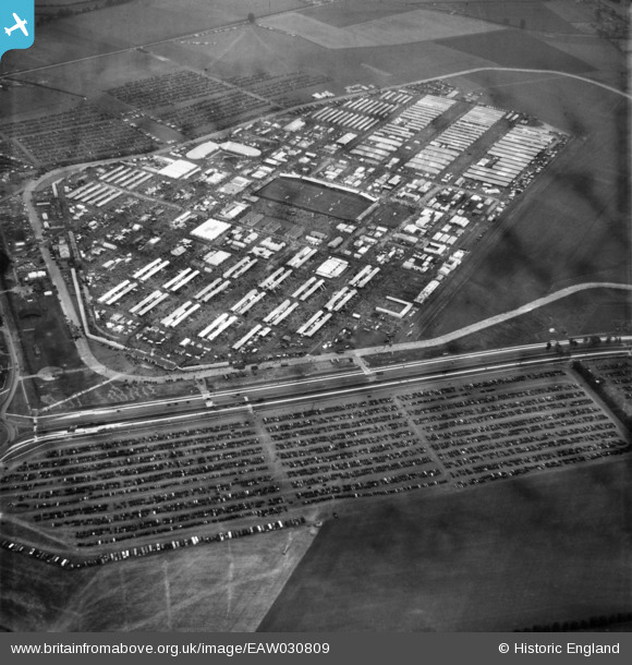
EAW030809 ENGLAND (1950). The Royal Agricultural Society of England Royal Show, Kidlington, 1950
© Copyright OpenStreetMap contributors and licensed by the OpenStreetMap Foundation. 2026. Cartography is licensed as CC BY-SA.
Nearby Images (9)
EAW030809

EAW030818

EAW030807

EAW049189
, Kidlington, from the south, 1953")
EAW049192
, Kidlington, from the south-west, 1953")
EAW030811

EAW030802

EAW030812

EAW049193
, Kidlington, from the west, 1953")
Details
| Title | [EAW030809] The Royal Agricultural Society of England Royal Show, Kidlington, 1950 |
| Reference | EAW030809 |
| Date | 5-July-1950 |
| Link | |
| Place name | KIDLINGTON |
| Parish | KIDLINGTON |
| District | |
| Country | ENGLAND |
| Easting / Northing | 446261, 215509 |
| Longitude / Latitude | -1.3285231006888, 51.83582769081 |
| National Grid Reference | SP463155 |
Pins
Be the first to add a comment to this image!