
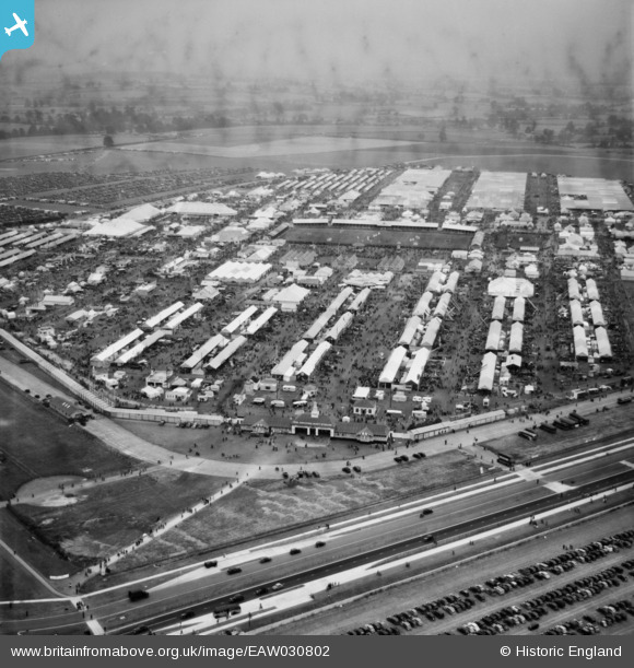
EAW030802 ENGLAND (1950). The Royal Agricultural Society of England Royal Show, Kidlington, from the south-west, 1950
© Copyright OpenStreetMap contributors and licensed by the OpenStreetMap Foundation. 2026. Cartography is licensed as CC BY-SA.
Nearby Images (12)
EAW030802

EAW049193
, Kidlington, from the west, 1953")
EAW030813

EAW049192
, Kidlington, from the south-west, 1953")
EAW030818

EAW030803

EAW030812

EAW030816

EAW030814

EAW030809

EAW049187
, Kidlington, 1953")
EAW049191
, Kidlington, 1953")
Details
| Title | [EAW030802] The Royal Agricultural Society of England Royal Show, Kidlington, from the south-west, 1950 |
| Reference | EAW030802 |
| Date | 5-July-1950 |
| Link | |
| Place name | KIDLINGTON |
| Parish | KIDLINGTON |
| District | |
| Country | ENGLAND |
| Easting / Northing | 446023, 215615 |
| Longitude / Latitude | -1.3319633046112, 51.836800445456 |
| National Grid Reference | SP460156 |
Pins
Be the first to add a comment to this image!