
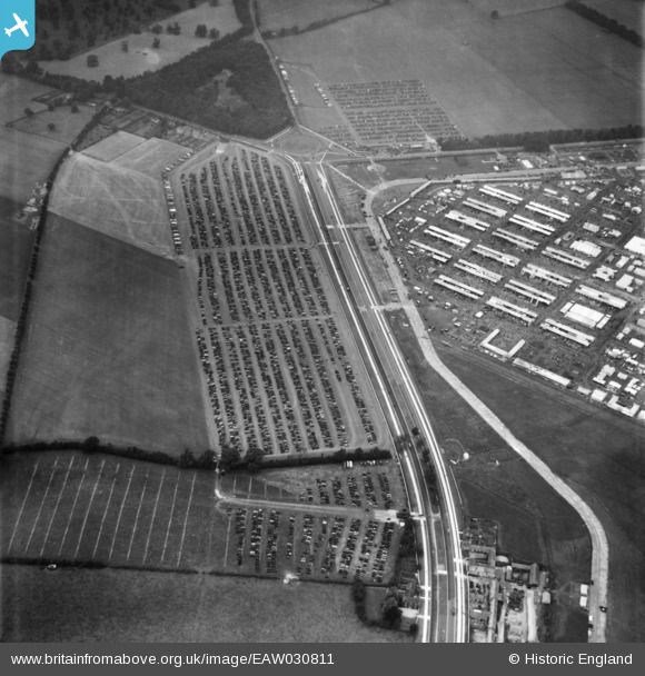
EAW030811 ENGLAND (1950). Car parks along Woodstock Road at the Royal Agricultural Society of England Royal Show, Kidlington, 1950
© Copyright OpenStreetMap contributors and licensed by the OpenStreetMap Foundation. 2026. Cartography is licensed as CC BY-SA.
Nearby Images (6)
EAW030811

EAW030812

EAW030803

EAW030816

EAW030809

EAW030813

Details
| Title | [EAW030811] Car parks along Woodstock Road at the Royal Agricultural Society of England Royal Show, Kidlington, 1950 |
| Reference | EAW030811 |
| Date | 5-July-1950 |
| Link | |
| Place name | KIDLINGTON |
| Parish | KIDLINGTON |
| District | |
| Country | ENGLAND |
| Easting / Northing | 446141, 215348 |
| Longitude / Latitude | -1.3302862439361, 51.83439000849 |
| National Grid Reference | SP461153 |
Pins
Be the first to add a comment to this image!