
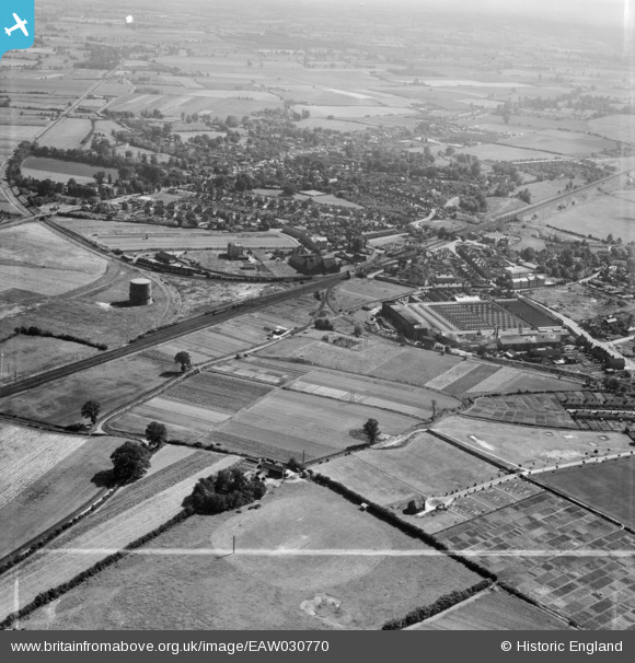
EAW030770 ENGLAND (1950). The Crittall Steel Works and the town, Witham, 1950. This image was marked by Aerofilms Ltd for photo editing.
© Copyright OpenStreetMap contributors and licensed by the OpenStreetMap Foundation. 2026. Cartography is licensed as CC BY-SA.
Nearby Images (8)
EAW030770

EAW030769

EAW030771

EPW022309

EPW022308

EAW030767

EPW022306

EAW030761

Details
| Title | [EAW030770] The Crittall Steel Works and the town, Witham, 1950. This image was marked by Aerofilms Ltd for photo editing. |
| Reference | EAW030770 |
| Date | 28-June-1950 |
| Link | |
| Place name | WITHAM |
| Parish | WITHAM |
| District | |
| Country | ENGLAND |
| Easting / Northing | 582239, 215464 |
| Longitude / Latitude | 0.64374747487808, 51.807616693739 |
| National Grid Reference | TL822155 |
Pins

Matt Aldred edob.mattaldred.com |
Thursday 11th of June 2020 07:23:07 PM | |
|
Matt Aldred edob.mattaldred.com |
Thursday 11th of June 2020 07:22:49 PM | |

Sparky |
Wednesday 6th of September 2017 06:15:03 PM |