
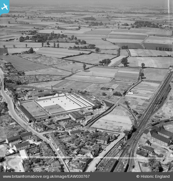
EAW030767 ENGLAND (1950). The Crittall Steel Works and the surrounding countryside, Witham, from the south, 1950. This image was marked by Aerofilms Ltd for photo editing.
© Copyright OpenStreetMap contributors and licensed by the OpenStreetMap Foundation. 2026. Cartography is licensed as CC BY-SA.
Nearby Images (17)
EAW030767

EAW030769

EAW030761

EPW022308

EPW022306

EAW030762

EAW030764

EAW030763

EAW030766

EPW022309

EAW030765

EAW030770

EAW030771

EAW021809

EAW021815

EAW021811

EAW021810

Details
| Title | [EAW030767] The Crittall Steel Works and the surrounding countryside, Witham, from the south, 1950. This image was marked by Aerofilms Ltd for photo editing. |
| Reference | EAW030767 |
| Date | 28-June-1950 |
| Link | |
| Place name | WITHAM |
| Parish | WITHAM |
| District | |
| Country | ENGLAND |
| Easting / Northing | 582088, 215350 |
| Longitude / Latitude | 0.64149952818879, 51.806641894565 |
| National Grid Reference | TL821154 |
Pins

Matt Aldred edob.mattaldred.com |
Thursday 11th of June 2020 07:29:59 PM | |
|
Matt Aldred edob.mattaldred.com |
Thursday 11th of June 2020 07:29:38 PM | |

Sparky |
Wednesday 6th of September 2017 06:19:09 PM |