
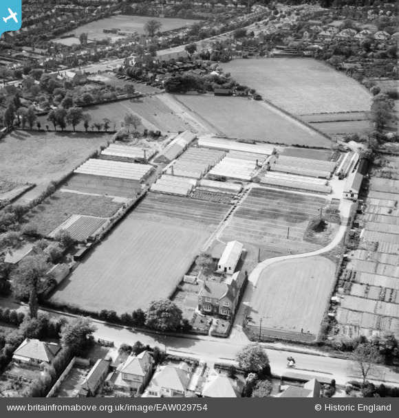
EAW029754 ENGLAND (1950). The Sandy Hill Nursery, Shirley, 1950
© Copyright OpenStreetMap contributors and licensed by the OpenStreetMap Foundation. 2026. Cartography is licensed as CC BY-SA.
Nearby Images (14)
EAW029754

EPW059190

EPW059192

EAW029760

EPW059191

EAW029759

EAW029761

EPW059194

EAW029757

EAW029762

EPW059193

EAW029755

EAW029756

EAW029758

Details
| Title | [EAW029754] The Sandy Hill Nursery, Shirley, 1950 |
| Reference | EAW029754 |
| Date | 31-May-1950 |
| Link | |
| Place name | SHIRLEY |
| Parish | |
| District | |
| Country | ENGLAND |
| Easting / Northing | 411795, 280090 |
| Longitude / Latitude | -1.8265498974413, 52.418299960971 |
| National Grid Reference | SP118801 |
Pins
Be the first to add a comment to this image!