
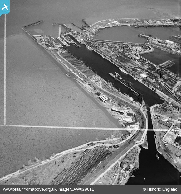
EAW029011 ENGLAND (1950). The Royal Dock, Grimsby, 1950. This image was marked by Aerofilms Ltd for photo editing.
© Copyright OpenStreetMap contributors and licensed by the OpenStreetMap Foundation. 2026. Cartography is licensed as CC BY-SA.
Nearby Images (4)
EAW029011

EAW029015

EAW029012

EAW029231

Details
| Title | [EAW029011] The Royal Dock, Grimsby, 1950. This image was marked by Aerofilms Ltd for photo editing. |
| Reference | EAW029011 |
| Date | 10-May-1950 |
| Link | |
| Place name | GRIMSBY |
| Parish | |
| District | |
| Country | ENGLAND |
| Easting / Northing | 527425, 410895 |
| Longitude / Latitude | -0.075128882103761, 53.578906042182 |
| National Grid Reference | TA274109 |
Pins

redmist |
Wednesday 31st of October 2018 01:44:32 PM | |

Class31 |
Tuesday 4th of March 2014 06:55:12 PM | |
|
Class31 |
Monday 3rd of March 2014 07:47:57 PM | |
|
Class31 |
Monday 3rd of March 2014 04:58:26 PM |