
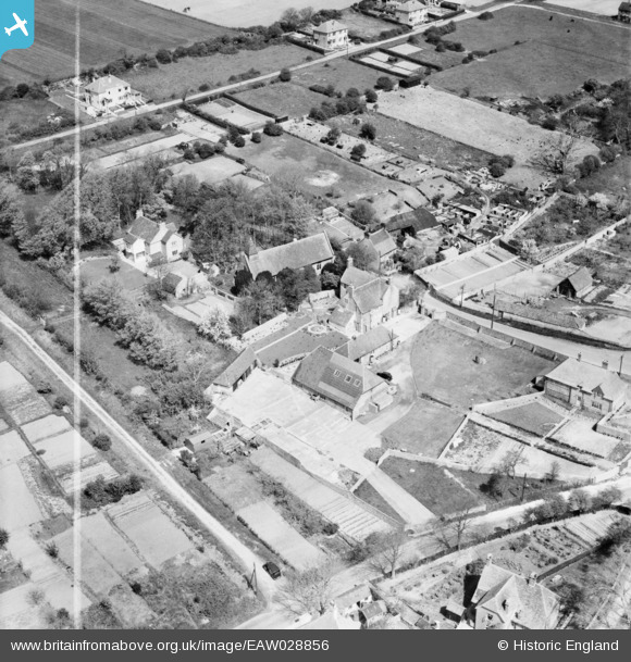
EAW028856 ENGLAND (1950). The village, Denton, 1950. This image was marked by Aerofilms Ltd for photo editing.
© Copyright OpenStreetMap contributors and licensed by the OpenStreetMap Foundation. 2026. Cartography is licensed as CC BY-SA.
Nearby Images (7)
EAW028856

EAW028861

EAW028857

EAW028858

EAW028859

EAW028860

EAW028855

Details
| Title | [EAW028856] The village, Denton, 1950. This image was marked by Aerofilms Ltd for photo editing. |
| Reference | EAW028856 |
| Date | 1-May-1950 |
| Link | |
| Place name | DENTON |
| Parish | NEWHAVEN |
| District | |
| Country | ENGLAND |
| Easting / Northing | 545450, 102560 |
| Longitude / Latitude | 0.064427100384615, 50.803752771694 |
| National Grid Reference | TQ455026 |
Pins

bescotbeast |
Sunday 10th of January 2021 04:49:13 PM | |
|
bescotbeast |
Friday 15th of May 2020 05:25:53 PM | |
|
bescotbeast |
Tuesday 18th of March 2014 08:26:23 PM | |
|
bescotbeast |
Tuesday 18th of March 2014 08:25:05 PM | |
|
bescotbeast |
Tuesday 18th of March 2014 08:24:44 PM |

User Comment Contributions
The above picturesque scene has been spoilt by housing development, only small fragments of the village survive. |
bescotbeast |
Tuesday 18th of March 2014 08:27:32 PM |