
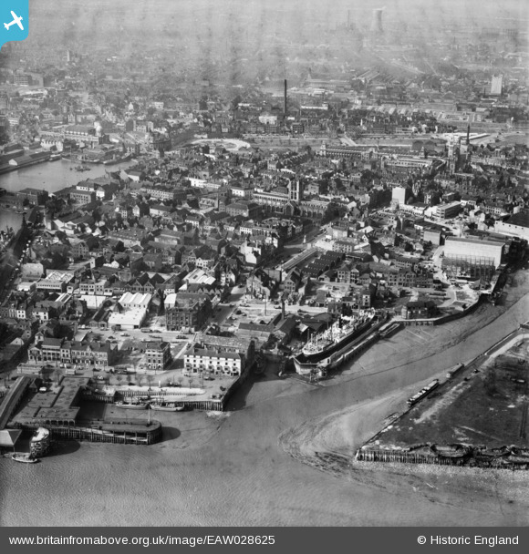
EAW028625 ENGLAND (1950). The mouth of the River Hull, Holy Trinity Church and the surrounding area, Kingston upon Hull, 1950
© Copyright OpenStreetMap contributors and licensed by the OpenStreetMap Foundation. 2026. Cartography is licensed as CC BY-SA.
Nearby Images (13)
EAW028625

EAW015644

EAW015638

EAW046134

EAW015645

EAW015658

EAW046136

EPW010789

EAW046145

EPW036413

EAW028626

EPW036382

EAW046146

Details
| Title | [EAW028625] The mouth of the River Hull, Holy Trinity Church and the surrounding area, Kingston upon Hull, 1950 |
| Reference | EAW028625 |
| Date | 5-April-1950 |
| Link | |
| Place name | KINGSTON UPON HULL |
| Parish | |
| District | |
| Country | ENGLAND |
| Easting / Northing | 509997, 428393 |
| Longitude / Latitude | -0.33206578362195, 53.740078128908 |
| National Grid Reference | TA100284 |
