
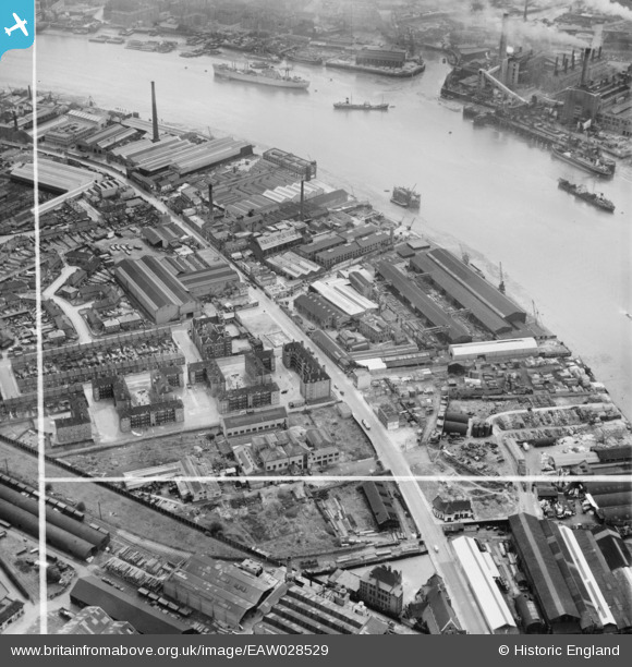
EAW028529 ENGLAND (1950). The Napier Yard, Deptford Power Stations and environs, Millwall, 1950. This image was marked by Aerofilms Ltd for photo editing.
© Copyright OpenStreetMap contributors and licensed by the OpenStreetMap Foundation. 2026. Cartography is licensed as CC BY-SA.
Nearby Images (11)
EAW028529

EAW028521

EAW028526

EAW028528

EAW028525

EAW028523

EAW028524

EAW028522

EAW028527

EAW021719

EPW025712

Details
| Title | [EAW028529] The Napier Yard, Deptford Power Stations and environs, Millwall, 1950. This image was marked by Aerofilms Ltd for photo editing. |
| Reference | EAW028529 |
| Date | 5-April-1950 |
| Link | |
| Place name | MILLWALL |
| Parish | |
| District | |
| Country | ENGLAND |
| Easting / Northing | 537521, 178523 |
| Longitude / Latitude | -0.019016323793602, 51.48842577388 |
| National Grid Reference | TQ375785 |
Pins

Hermann the German |
Wednesday 11th of October 2017 01:24:35 PM | |
|
Hermann the German |
Wednesday 11th of October 2017 01:22:21 PM |