
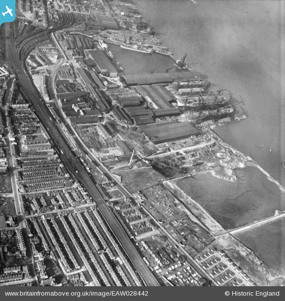
EAW028442 ENGLAND (1950). Cammell Laird's Shipbuilding and Engineering Works, Rock Ferry, 1950
© Copyright OpenStreetMap contributors and licensed by the OpenStreetMap Foundation. 2026. Cartography is licensed as CC BY-SA.
Nearby Images (16)
EAW028442

EPW004028

EAW028435

EAW028437

EAW028441

EAW029260

EAW030645

EAW030636

EAW029262

EAW028436

EAW030643

EAW030642

EAW028440

EAW029261

EPW004021

EAW029268

Details
| Title | [EAW028442] Cammell Laird's Shipbuilding and Engineering Works, Rock Ferry, 1950 |
| Reference | EAW028442 |
| Date | 25-March-1950 |
| Link | |
| Place name | ROCK FERRY |
| Parish | |
| District | |
| Country | ENGLAND |
| Easting / Northing | 332826, 387617 |
| Longitude / Latitude | -3.0099694963368, 53.380862402096 |
| National Grid Reference | SJ328876 |
Pins

beast66606 |
Monday 25th of July 2016 08:36:04 PM | |
|
beast66606 |
Monday 25th of July 2016 08:35:22 PM |