
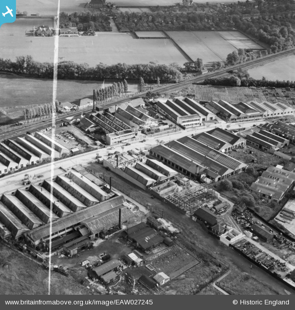
EAW027245 ENGLAND (1949). The Sydenham Industrial Estate, New Beckenham, 1949. This image was marked by Aerofilms Ltd for photo editing.
© Copyright OpenStreetMap contributors and licensed by the OpenStreetMap Foundation. 2026. Cartography is licensed as CC BY-SA.
Nearby Images (37)
EAW027245

EAW027249

EAW027250

EAW027244

EAW027248

EAW027252

EAW027247

EAW027251

EAW027246

EAW028749

EAW036998

EAW027242

EAW028514

EAW027259

EAW037000

EAW027253

EAW027256

EAW027243

EAW027257

EAW028513

EAW036994

EAW027254

EAW027239

EAW028510

EAW027238

EAW027258

EAW028748

EAW028752

EAW028511

EAW027255

EAW028508

EAW028750

EAW027237

EAW036996

EAW027241

EAW028512

EAW037001

Details
| Title | [EAW027245] The Sydenham Industrial Estate, New Beckenham, 1949. This image was marked by Aerofilms Ltd for photo editing. |
| Reference | EAW027245 |
| Date | 12-October-1949 |
| Link | |
| Place name | NEW BECKENHAM |
| Parish | |
| District | |
| Country | ENGLAND |
| Easting / Northing | 536722, 171185 |
| Longitude / Latitude | -0.033355597786291, 51.422671002613 |
| National Grid Reference | TQ367712 |
Pins
Be the first to add a comment to this image!