
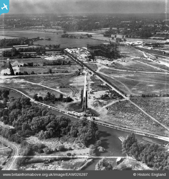
EAW026287 ENGLAND (1949). Rye House Power Station and Cooling Tower under construction, Ratty's Lane and environs, Rye Park, from the north-east, 1949. This image has been produced from a print marked by Aerofilms Ltd for photo editing.
© Copyright OpenStreetMap contributors and licensed by the OpenStreetMap Foundation. 2025. Cartography is licensed as CC BY-SA.
Nearby Images (15)
EAW026287

EAW026293

EAW022406

EAW050619

EAW026295

EAW026290

EAW050618

EAW022409

EAW022405

EAW042026

EAW026292

EAW026294

EAW050629

EAW050620

EAW053093

Details
| Title | [EAW026287] Rye House Power Station and Cooling Tower under construction, Ratty's Lane and environs, Rye Park, from the north-east, 1949. This image has been produced from a print marked by Aerofilms Ltd for photo editing. |
| Reference | EAW026287 |
| Date | 19-August-1949 |
| Link | |
| Place name | RYE PARK |
| Parish | |
| District | |
| Country | ENGLAND |
| Easting / Northing | 538994, 209004 |
| Longitude / Latitude | 0.014286600652039, 51.761991812763 |
| National Grid Reference | TL390090 |
Pins
Be the first to add a comment to this image!