
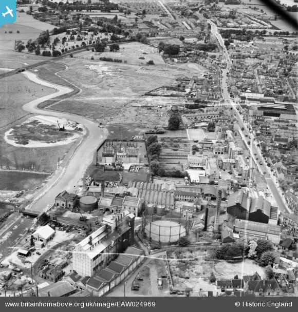
EAW024969 ENGLAND (1949). The Evode Ltd Polish and Adhesive Works, the Staffordshire General Infirmary and environs, Stafford, 1949. This image was marked by Aerofilms Ltd for photo editing.
© Copyright OpenStreetMap contributors and licensed by the OpenStreetMap Foundation. 2026. Cartography is licensed as CC BY-SA.
Nearby Images (20)
EAW024969

EPW020052

EAW024966

EAW024964

EAW024965

EAW024961
, Stafford, 1949. This image has been produced from a damaged negative.")
EAW024963

EAW024959

EAW024962
, Stafford, 1949. This image has been produced from a damaged negative.")
EPW034019

EAW024967

EAW024968

EPW056772

EPW056774

EPW056776

EPW056773

EPW056778

EPW017027

EPW056775

EPW020050

Details
| Title | [EAW024969] The Evode Ltd Polish and Adhesive Works, the Staffordshire General Infirmary and environs, Stafford, 1949. This image was marked by Aerofilms Ltd for photo editing. |
| Reference | EAW024969 |
| Date | 21-July-1949 |
| Link | |
| Place name | STAFFORD |
| Parish | |
| District | |
| Country | ENGLAND |
| Easting / Northing | 391867, 323663 |
| Longitude / Latitude | -2.1206713835879, 52.810122102422 |
| National Grid Reference | SJ919237 |
Pins

Nothing Better To Do |
Wednesday 7th of June 2023 11:37:21 AM |