
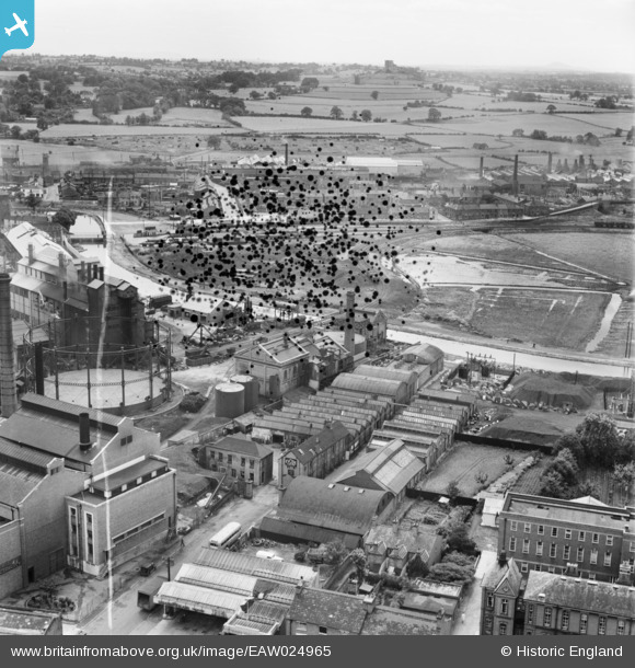
EAW024965 ENGLAND (1949). The Evode Ltd Polish and Adhesive Works, Stafford, 1949. This image has been produced from a damaged negative.
© Copyright OpenStreetMap contributors and licensed by the OpenStreetMap Foundation. 2026. Cartography is licensed as CC BY-SA.
Nearby Images (17)
EAW024965

EAW024964

EAW024966

EAW024963

EAW024961
, Stafford, 1949. This image has been produced from a damaged negative.")
EAW024962
, Stafford, 1949. This image has been produced from a damaged negative.")
EAW024967

EAW024968

EAW024969

EPW020052

EPW017027

EAW024959

EPW020050

EPW034019

EAW001867

EAW001864

EPW053380

Details
| Title | [EAW024965] The Evode Ltd Polish and Adhesive Works, Stafford, 1949. This image has been produced from a damaged negative. |
| Reference | EAW024965 |
| Date | 21-July-1949 |
| Link | |
| Place name | STAFFORD |
| Parish | |
| District | |
| Country | ENGLAND |
| Easting / Northing | 391954, 323570 |
| Longitude / Latitude | -2.1193782552735, 52.80928729248 |
| National Grid Reference | SJ920236 |
Pins
Be the first to add a comment to this image!