
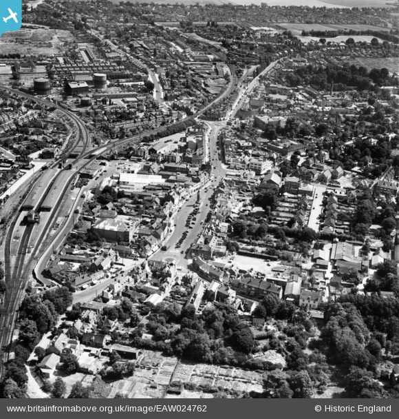
EAW024762 ENGLAND (1949). The town centre, Epsom, 1949
© Copyright OpenStreetMap contributors and licensed by the OpenStreetMap Foundation. 2026. Cartography is licensed as CC BY-SA.
Nearby Images (21)
EAW024762

EPW048876

EPW025148

EPW057023

EPW006480

EPW057024

EPW006492

EPW048877

EPW025143

EPW025262

EPW025146

EAW024760

EAW043022

EAW043020

EAW043021

EAW043025

EAW043019

EAW043023

EAW043026

EAW043024

EAW043017

Details
| Title | [EAW024762] The town centre, Epsom, 1949 |
| Reference | EAW024762 |
| Date | 12-July-1949 |
| Link | |
| Place name | EPSOM |
| Parish | |
| District | |
| Country | ENGLAND |
| Easting / Northing | 520714, 160758 |
| Longitude / Latitude | -0.26704146582615, 51.332583481827 |
| National Grid Reference | TQ207608 |
Pins

Matt Aldred edob.mattaldred.com |
Friday 27th of September 2024 04:52:59 PM | |
|
Matt Aldred edob.mattaldred.com |
Friday 27th of September 2024 04:52:27 PM | |

Class31 |
Tuesday 21st of June 2016 07:32:48 AM | |
|
Class31 |
Tuesday 21st of June 2016 07:32:09 AM | |
 |

Billy Turner |
Friday 1st of January 2016 08:24:05 PM |


