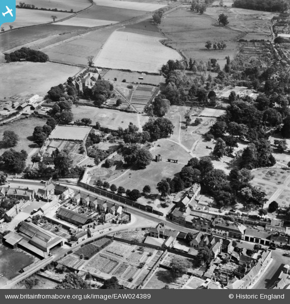
EAW024389 ENGLAND (1949). The Abbey Gardens, Bury St Edmunds, 1949
© Copyright OpenStreetMap contributors and licensed by the OpenStreetMap Foundation. 2026. Cartography is licensed as CC BY-SA.
Nearby Images (9)
Details
| Title | [EAW024389] The Abbey Gardens, Bury St Edmunds, 1949 |
| Reference | EAW024389 |
| Date | 6-July-1949 |
| Link | |
| Place name | BURY ST EDMUNDS |
| Parish | BURY ST. EDMUNDS |
| District | |
| Country | ENGLAND |
| Easting / Northing | 585807, 264247 |
| Longitude / Latitude | 0.72193690296103, 52.24459387577 |
| National Grid Reference | TL858642 |
Pins

Matt Aldred edob.mattaldred.com |
Tuesday 7th of May 2019 04:35:45 PM | |

Matt Aldred edob.mattaldred.com |
Tuesday 7th of May 2019 04:35:26 PM |


![[EAW024389] The Abbey Gardens, Bury St Edmunds, 1949](http://britainfromabove.org.uk/sites/all/libraries/aerofilms-images/public/100x100/EAW/024/EAW024389.jpg)
![[EAW029744] The abbey site and the town, Bury St Edmunds, 1950](http://britainfromabove.org.uk/sites/all/libraries/aerofilms-images/public/100x100/EAW/029/EAW029744.jpg)
![[EAW024396] The Abbey Gardens and environs, Bury St Edmunds, 1949](http://britainfromabove.org.uk/sites/all/libraries/aerofilms-images/public/100x100/EAW/024/EAW024396.jpg)
![[EAW024387] The Abbey Gardens and environs, Bury St Edmunds, 1949](http://britainfromabove.org.uk/sites/all/libraries/aerofilms-images/public/100x100/EAW/024/EAW024387.jpg)
![[EAW024395] St James' Cathedral, Abbey Gardens and Crown Street, Bury St Edmunds, 1949](http://britainfromabove.org.uk/sites/all/libraries/aerofilms-images/public/100x100/EAW/024/EAW024395.jpg)
![[EAW024397] St James' Cathedral and the Abbey Gardens, Bury St Edmunds, 1949](http://britainfromabove.org.uk/sites/all/libraries/aerofilms-images/public/100x100/EAW/024/EAW024397.jpg)
![[EAW024398] St James' Cathedral, the Abbey Gardens and Angel Hill, Bury St Edmunds, 1949](http://britainfromabove.org.uk/sites/all/libraries/aerofilms-images/public/100x100/EAW/024/EAW024398.jpg)
![[EAW024388] The Abbey Gardens and environs, Bury St Edmunds, 1949](http://britainfromabove.org.uk/sites/all/libraries/aerofilms-images/public/100x100/EAW/024/EAW024388.jpg)
![[EPW025021] St James' Cathedral and St Mary's Church, Bury St Edmunds, 1928](http://britainfromabove.org.uk/sites/all/libraries/aerofilms-images/public/100x100/EPW/025/EPW025021.jpg)