
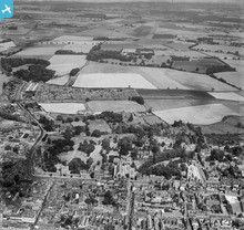
EAW024387 ENGLAND (1949). The Abbey Gardens and environs, Bury St Edmunds, 1949

© Copyright OpenStreetMap contributors and licensed by the OpenStreetMap Foundation. 2026. Cartography is licensed as CC BY-SA.
Nearby Images (5)
EAW024387

EAW024388

EAW024389

EAW029744

EPW001773

Details
| Title | [EAW024387] The Abbey Gardens and environs, Bury St Edmunds, 1949 |
| Reference | EAW024387 |
| Date | 6-July-1949 |
| Link | |
| Place name | BURY ST EDMUNDS |
| Parish | BURY ST. EDMUNDS |
| District | |
| Country | ENGLAND |
| Easting / Northing | 585984, 264203 |
| Longitude / Latitude | 0.72450242633781, 52.244138921026 |
| National Grid Reference | TL860642 |
Pins

Matt Aldred edob.mattaldred.com |
Tuesday 1st of December 2020 07:49:11 PM | |

incony |
Tuesday 17th of October 2017 08:42:53 PM | |
|
cptpies |
Monday 16th of December 2013 01:49:37 PM |
User Comment Contributions
Type 22 AA variant pillbox, Bury St Edmunds. |
cptpies |
Thursday 19th of December 2013 01:49:20 PM |