
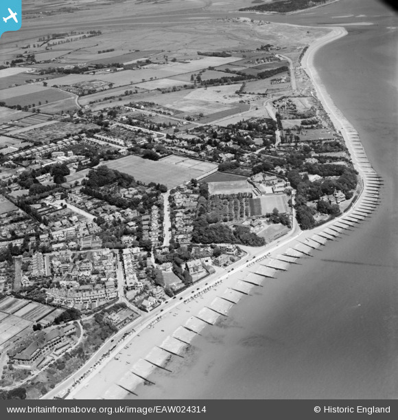
EAW024314 ENGLAND (1949). Cobbolds Point and environs, Felixstowe, 1949
© Copyright OpenStreetMap contributors and licensed by the OpenStreetMap Foundation. 2026. Cartography is licensed as CC BY-SA.
Nearby Images (8)
EAW024314

EAW024317

EAW024316

EAW024318

EAW024311

EAW024312

EAW024313

EAW024315

Details
| Title | [EAW024314] Cobbolds Point and environs, Felixstowe, 1949 |
| Reference | EAW024314 |
| Date | 4-July-1949 |
| Link | |
| Place name | FELIXSTOWE |
| Parish | FELIXSTOWE |
| District | |
| Country | ENGLAND |
| Easting / Northing | 631346, 235007 |
| Longitude / Latitude | 1.3680634399509, 51.964886025772 |
| National Grid Reference | TM313350 |
Pins

Matt Aldred edob.mattaldred.com |
Tuesday 7th of July 2026 05:16:31 PM | |

redmist |
Wednesday 10th of December 2025 08:37:47 PM | |
|
redmist |
Wednesday 10th of December 2025 08:34:50 PM | |
|
redmist |
Wednesday 10th of December 2025 08:33:45 PM | |
|
redmist |
Wednesday 10th of December 2025 08:32:47 PM | |
|
redmist |
Friday 31st of January 2025 08:20:50 PM | |
|
redmist |
Friday 31st of January 2025 08:14:47 PM | |
|
Matt Aldred edob.mattaldred.com |
Tuesday 9th of March 2021 01:34:41 PM | |
|
Matt Aldred edob.mattaldred.com |
Tuesday 9th of March 2021 01:34:24 PM | |
|
Matt Aldred edob.mattaldred.com |
Tuesday 9th of March 2021 01:34:05 PM | |
|
Al |
Thursday 2nd of October 2014 03:04:52 PM | |
|
cptpies |
Tuesday 14th of January 2014 10:15:31 AM | |
|
cptpies |
Tuesday 14th of January 2014 10:14:21 AM | |
|
cptpies |
Tuesday 14th of January 2014 10:07:56 AM |
User Comment Contributions

Previously unrecorded coast artillery battery and pillboxes. |
cptpies |
Tuesday 14th of January 2014 10:18:58 AM |