
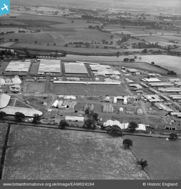
EAW024194 ENGLAND (1949). The Royal Agricultural Society of England Royal Show, Shrewsbury, 1949
© Copyright OpenStreetMap contributors and licensed by the OpenStreetMap Foundation. 2026. Cartography is licensed as CC BY-SA.
Nearby Images (7)
EAW024194

EAW024195

EAW024190

EAW024184

EAW024187

EAW024188

EAW024193

Details
| Title | [EAW024194] The Royal Agricultural Society of England Royal Show, Shrewsbury, 1949 |
| Reference | EAW024194 |
| Date | 27-June-1949 |
| Link | |
| Place name | SHREWSBURY |
| Parish | SHREWSBURY |
| District | |
| Country | ENGLAND |
| Easting / Northing | 351757, 314617 |
| Longitude / Latitude | -2.7144316547421, 52.726702871517 |
| National Grid Reference | SJ518146 |
Pins
Be the first to add a comment to this image!