
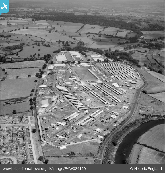
EAW024190 ENGLAND (1949). The Royal Agricultural Society of England Royal Show, Shrewsbury, 1949
© Copyright OpenStreetMap contributors and licensed by the OpenStreetMap Foundation. 2026. Cartography is licensed as CC BY-SA.
Nearby Images (7)
EAW024190

EAW024194

EAW024195

EAW024187

EAW024193

EAW024184

EAW024189

Details
| Title | [EAW024190] The Royal Agricultural Society of England Royal Show, Shrewsbury, 1949 |
| Reference | EAW024190 |
| Date | 27-June-1949 |
| Link | |
| Place name | SHREWSBURY |
| Parish | SHREWSBURY |
| District | |
| Country | ENGLAND |
| Easting / Northing | 351806, 314623 |
| Longitude / Latitude | -2.7137069547452, 52.726761180025 |
| National Grid Reference | SJ518146 |
Pins

Jon |
Tuesday 4th of April 2017 07:09:20 PM |