
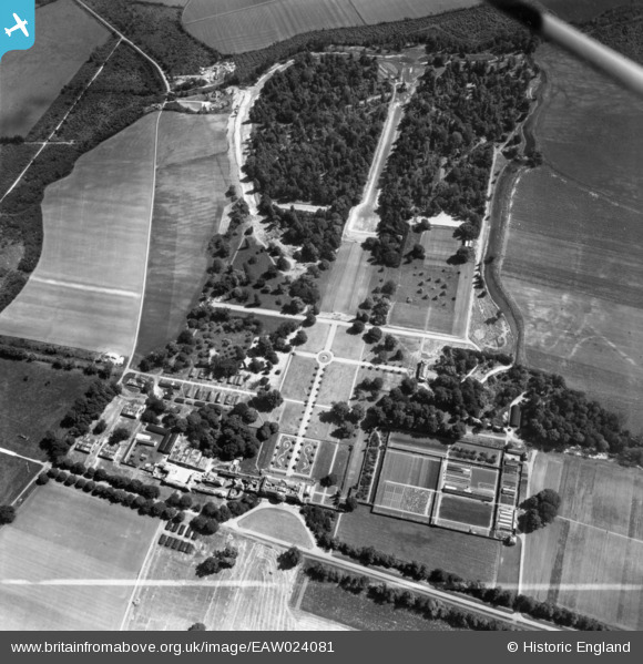
EAW024081 ENGLAND (1949). The National Institute of Agricultural Engineering at Wrest Park, Silsoe, 1949. This image has been produced from a print marked by Aerofilms Ltd for photo editing.
© Copyright OpenStreetMap contributors and licensed by the OpenStreetMap Foundation. 2025. Cartography is licensed as CC BY-SA.
Nearby Images (4)
EAW024081

EAW024080

EAW024083

EAW024082

Details
| Title | [EAW024081] The National Institute of Agricultural Engineering at Wrest Park, Silsoe, 1949. This image has been produced from a print marked by Aerofilms Ltd for photo editing. |
| Reference | EAW024081 |
| Date | 20-June-1949 |
| Link | |
| Place name | SILSOE |
| Parish | SILSOE |
| District | |
| Country | ENGLAND |
| Easting / Northing | 509148, 235307 |
| Longitude / Latitude | -0.40971243562545, 52.005030140719 |
| National Grid Reference | TL091353 |
Pins

brian |
Tuesday 2nd of September 2014 12:26:49 AM | |
|
brian |
Tuesday 2nd of September 2014 12:23:42 AM | |
|
brian |
Tuesday 2nd of September 2014 12:22:48 AM | |
|
brian |
Tuesday 2nd of September 2014 12:21:49 AM | |
|
brian |
Tuesday 2nd of September 2014 12:21:09 AM | |
|
brian |
Tuesday 2nd of September 2014 12:20:17 AM | |
|
brian |
Tuesday 2nd of September 2014 12:19:08 AM | |
|
brian |
Tuesday 2nd of September 2014 12:18:35 AM | |
|
brian |
Tuesday 2nd of September 2014 12:17:46 AM | |
|
brian |
Tuesday 2nd of September 2014 12:16:58 AM |