
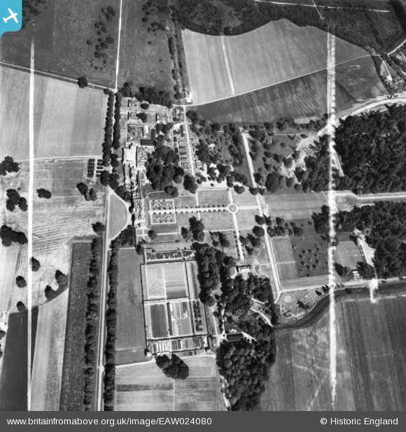
EAW024080 ENGLAND (1949). The National Institute of Agricultural Engineering at Wrest Park, Silsoe, 1949. This image has been produced from a print marked by Aerofilms Ltd for photo editing.
© Copyright OpenStreetMap contributors and licensed by the OpenStreetMap Foundation. 2025. Cartography is licensed as CC BY-SA.
Nearby Images (3)
EAW024080

EAW049228

EAW024081

Details
| Title | [EAW024080] The National Institute of Agricultural Engineering at Wrest Park, Silsoe, 1949. This image has been produced from a print marked by Aerofilms Ltd for photo editing. |
| Reference | EAW024080 |
| Date | 20-June-1949 |
| Link | |
| Place name | SILSOE |
| Parish | SILSOE |
| District | |
| Country | ENGLAND |
| Easting / Northing | 509114, 235447 |
| Longitude / Latitude | -0.41016301184894, 52.006295183321 |
| National Grid Reference | TL091354 |
Pins

brian |
Tuesday 2nd of September 2014 01:16:05 AM | |
|
brian |
Tuesday 2nd of September 2014 01:15:33 AM | |
|
brian |
Tuesday 2nd of September 2014 01:14:56 AM | |
|
brian |
Tuesday 2nd of September 2014 01:13:04 AM | |
|
brian |
Tuesday 2nd of September 2014 01:12:29 AM | |
|
brian |
Tuesday 2nd of September 2014 01:11:51 AM | |
|
brian |
Tuesday 2nd of September 2014 01:11:03 AM | |
|
brian |
Tuesday 2nd of September 2014 01:10:18 AM |