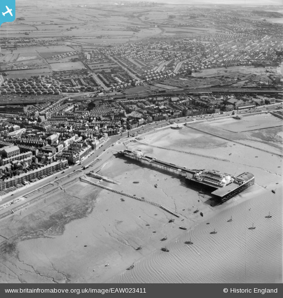
EAW023411 ENGLAND (1949). The Central Pier, Morecombe, 1949
© Copyright OpenStreetMap contributors and licensed by the OpenStreetMap Foundation. 2026. Cartography is licensed as CC BY-SA.
Nearby Images (7)
Details
| Title | [EAW023411] The Central Pier, Morecombe, 1949 |
| Reference | EAW023411 |
| Date | 25-May-1949 |
| Link | |
| Place name | MORECOMBE |
| Parish | MORECAMBE |
| District | |
| Country | ENGLAND |
| Easting / Northing | 343403, 464557 |
| Longitude / Latitude | -2.8650443644979, 54.073646899327 |
| National Grid Reference | SD434646 |
Pins

Matt Aldred edob.mattaldred.com |
Tuesday 9th of March 2021 01:57:44 PM | |

redmist |
Saturday 5th of December 2020 09:35:02 PM | |

redmist |
Saturday 5th of December 2020 09:30:56 PM | |

redmist |
Saturday 5th of December 2020 09:27:51 PM |


![[EAW023411] The Central Pier, Morecombe, 1949](http://britainfromabove.org.uk/sites/all/libraries/aerofilms-images/public/100x100/EAW/023/EAW023411.jpg)
![[EPW042132] Morecambe Harbour, Central Pier and the town, Morecambe, 1933](http://britainfromabove.org.uk/sites/all/libraries/aerofilms-images/public/100x100/EPW/042/EPW042132.jpg)
![[EPW042128] Morecambe Harbour and Central Pier, Morecambe, 1933](http://britainfromabove.org.uk/sites/all/libraries/aerofilms-images/public/100x100/EPW/042/EPW042128.jpg)
![[EPW042137] Central Pier, Morecambe, 1933](http://britainfromabove.org.uk/sites/all/libraries/aerofilms-images/public/100x100/EPW/042/EPW042137.jpg)
![[EPW042129] Central Pier, Morecambe, 1933](http://britainfromabove.org.uk/sites/all/libraries/aerofilms-images/public/100x100/EPW/042/EPW042129.jpg)
![[EAW023410] Marine Road Central and environs, Morecombe, 1949](http://britainfromabove.org.uk/sites/all/libraries/aerofilms-images/public/100x100/EAW/023/EAW023410.jpg)
![[EPW042135] The town, Morecambe, 1933](http://britainfromabove.org.uk/sites/all/libraries/aerofilms-images/public/100x100/EPW/042/EPW042135.jpg)