
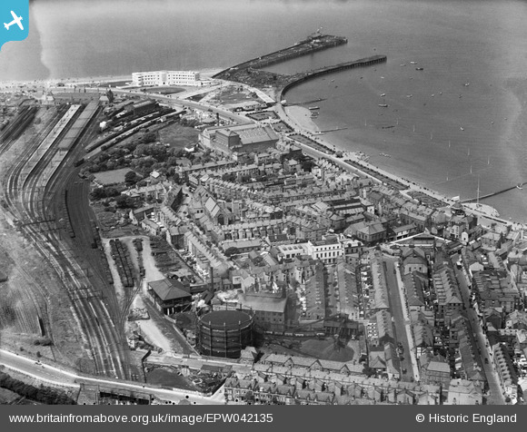
EPW042135 ENGLAND (1933). The town, Morecambe, 1933
© Copyright OpenStreetMap contributors and licensed by the OpenStreetMap Foundation. 2026. Cartography is licensed as CC BY-SA.
Nearby Images (5)
EPW042135

EPW004072

EPW042133

EPW042132

EAW023411

Details
| Title | [EPW042135] The town, Morecambe, 1933 |
| Reference | EPW042135 |
| Date | June-1933 |
| Link | |
| Place name | MORECAMBE |
| Parish | MORECAMBE |
| District | |
| Country | ENGLAND |
| Easting / Northing | 343246, 464330 |
| Longitude / Latitude | -2.8674011623111, 54.071589444434 |
| National Grid Reference | SD432643 |
Pins

Bob Fleetwood |
Wednesday 9th of December 2020 09:09:09 PM | |
|
LankyBod |
Sunday 24th of April 2016 02:17:16 AM | |
|
wadey |
Tuesday 26th of August 2014 09:39:39 PM | |
|
wadey |
Tuesday 26th of August 2014 09:38:24 PM | |
|
wadey |
Tuesday 26th of August 2014 09:37:21 PM | |
|
Bob Fleetwood |
Thursday 18th of July 2013 02:11:11 PM | |
|
Bob Fleetwood |
Thursday 18th of July 2013 02:10:43 PM | |
|
Bob Fleetwood |
Thursday 18th of July 2013 02:10:02 PM |