
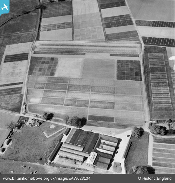
EAW023134 ENGLAND (1949). Rothamsted Experimental Farm, Rothamsted, 1949
© Copyright OpenStreetMap contributors and licensed by the OpenStreetMap Foundation. 2026. Cartography is licensed as CC BY-SA.
Nearby Images (17)
EAW023134

EAW023125

EAW023129

EAW023124

EAW023123

EAW023127

EAW023121

EAW023126

EAW023133

EAW023128

EAW023122

EAW023130

EAW023131

EAW041170

EAW023132

EAW041169

EAW041171

Details
| Title | [EAW023134] Rothamsted Experimental Farm, Rothamsted, 1949 |
| Reference | EAW023134 |
| Date | 13-May-1949 |
| Link | |
| Place name | ROTHAMSTED |
| Parish | HARPENDEN RURAL |
| District | |
| Country | ENGLAND |
| Easting / Northing | 512038, 213805 |
| Longitude / Latitude | -0.37461660856055, 51.811189059742 |
| National Grid Reference | TL120138 |
Pins

Sparky |
Monday 28th of August 2017 11:49:00 AM |