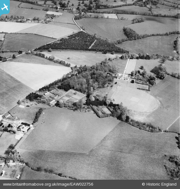
EAW022756 ENGLAND (1949). The Oratory School, Three Cornered Wood and environs, Woodcote, 1949
© Copyright OpenStreetMap contributors and licensed by the OpenStreetMap Foundation. 2025. Cartography is licensed as CC BY-SA.
Details
| Title | [EAW022756] The Oratory School, Three Cornered Wood and environs, Woodcote, 1949 |
| Reference | EAW022756 |
| Date | 29-April-1949 |
| Link | |
| Place name | WOODCOTE |
| Parish | WOODCOTE |
| District | |
| Country | ENGLAND |
| Easting / Northing | 465264, 181818 |
| Longitude / Latitude | -1.0590305653364, 51.531013976654 |
| National Grid Reference | SU653818 |
Pins
Robert Tims |
Thursday 2nd of January 2014 04:46:41 PM | |
Robert Tims |
Thursday 2nd of January 2014 04:45:18 PM |


![[EAW022756] The Oratory School, Three Cornered Wood and environs, Woodcote, 1949](http://britainfromabove.org.uk/sites/all/libraries/aerofilms-images/public/100x100/EAW/022/EAW022756.jpg)
![[EAW022754] The Oratory School, Woodcote, 1949](http://britainfromabove.org.uk/sites/all/libraries/aerofilms-images/public/100x100/EAW/022/EAW022754.jpg)
![[EAW022755] The Oratory School, Woodcote, 1949. This image was marked by Aerofilms Ltd for photo editing.](http://britainfromabove.org.uk/sites/all/libraries/aerofilms-images/public/100x100/EAW/022/EAW022755.jpg)
![[EAW022757] The Oratory School and environs, Woodcote, from the south-east 1949](http://britainfromabove.org.uk/sites/all/libraries/aerofilms-images/public/100x100/EAW/022/EAW022757.jpg)