
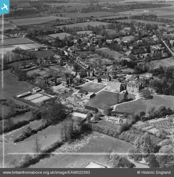
EAW022393 ENGLAND (1949). Bishop's Stortford College and environs, Bishop's Stortford, 1949. This image was marked by Aerofilms Ltd for photo editing.
© Copyright OpenStreetMap contributors and licensed by the OpenStreetMap Foundation. 2026. Cartography is licensed as CC BY-SA.
Nearby Images (7)
EAW022393

EAW022394

EAW022391

EAW022395

EAW022390

EAW022392

EPW001771

Details
| Title | [EAW022393] Bishop's Stortford College and environs, Bishop's Stortford, 1949. This image was marked by Aerofilms Ltd for photo editing. |
| Reference | EAW022393 |
| Date | 20-April-1949 |
| Link | |
| Place name | BISHOP'S STORTFORD |
| Parish | BISHOP'S STORTFORD |
| District | |
| Country | ENGLAND |
| Easting / Northing | 548053, 221357 |
| Longitude / Latitude | 0.15075270704251, 51.870670091653 |
| National Grid Reference | TL481214 |
Pins
Be the first to add a comment to this image!