
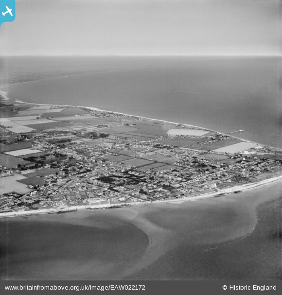
EAW022172 ENGLAND (1949). Selsey Bill and the town, Selsey, from the south-west, 1949
© Copyright OpenStreetMap contributors and licensed by the OpenStreetMap Foundation. 2026. Cartography is licensed as CC BY-SA.
Nearby Images (6)
EAW022172

EAW022175

EAW022173

EPW024669

EAW022170

EAW022171

Details
| Title | [EAW022172] Selsey Bill and the town, Selsey, from the south-west, 1949 |
| Reference | EAW022172 |
| Date | 17-May-1949 |
| Link | |
| Place name | SELSEY |
| Parish | SELSEY |
| District | |
| Country | ENGLAND |
| Easting / Northing | 484784, 92587 |
| Longitude / Latitude | -0.79865242352655, 50.726137705399 |
| National Grid Reference | SZ848926 |
Pins

Matt Aldred edob.mattaldred.com |
Tuesday 16th of September 2025 09:33:19 AM | |

C J COLE |
Sunday 25th of September 2022 02:26:13 PM | |
|
Geoff |
Sunday 14th of May 2017 05:10:55 PM |