
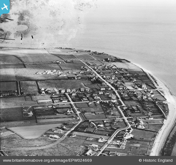
EPW024669 ENGLAND (1928). Seal Road and environs, Selsey, from the north-west, 1928
© Copyright OpenStreetMap contributors and licensed by the OpenStreetMap Foundation. 2026. Cartography is licensed as CC BY-SA.
Nearby Images (5)
EPW024669

EPW024676

EAW022172

EPW024670

EAW022170

Details
| Title | [EPW024669] Seal Road and environs, Selsey, from the north-west, 1928 |
| Reference | EPW024669 |
| Date | October-1928 |
| Link | |
| Place name | SELSEY |
| Parish | SELSEY |
| District | |
| Country | ENGLAND |
| Easting / Northing | 484936, 92735 |
| Longitude / Latitude | -0.79646506653599, 50.727446271398 |
| National Grid Reference | SZ849927 |
Pins
Be the first to add a comment to this image!