
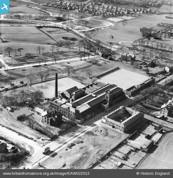
EAW022013 ENGLAND (1949). Balderstone Cotton Mill, Balderstone, 1949
© Copyright OpenStreetMap contributors and licensed by the OpenStreetMap Foundation. 2026. Cartography is licensed as CC BY-SA.
Nearby Images (7)
EAW022013

EAW022015

EAW022010

EAW022014

EAW022012

EAW022011

EAW022009

Details
| Title | [EAW022013] Balderstone Cotton Mill, Balderstone, 1949 |
| Reference | EAW022013 |
| Date | 14-April-1949 |
| Link | |
| Place name | BALDERSTONE |
| Parish | |
| District | |
| Country | ENGLAND |
| Easting / Northing | 390477, 410964 |
| Longitude / Latitude | -2.1439001055022, 53.594925154553 |
| National Grid Reference | SD905110 |
