
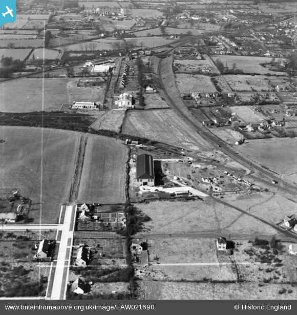
EAW021690 ENGLAND (1949). Edward Farr Ltd Engineering Works and environs, Wickford, 1949. This image has been produced from a print marked by Aerofilms Ltd for photo editing.
© Copyright OpenStreetMap contributors and licensed by the OpenStreetMap Foundation. 2026. Cartography is licensed as CC BY-SA.
Nearby Images (17)
EAW021690

EAW021692

EAW046617

EAW046621

EAW046614

EAW046619

EAW021687

EAW021689

EAW046622

EAW046615

EAW046618

EAW046620

EAW021688

EAW046616

EAW021691

EAW021693

EAW021686

Details
| Title | [EAW021690] Edward Farr Ltd Engineering Works and environs, Wickford, 1949. This image has been produced from a print marked by Aerofilms Ltd for photo editing. |
| Reference | EAW021690 |
| Date | 24-March-1949 |
| Link | |
| Place name | WICKFORD |
| Parish | SHOTGATE |
| District | |
| Country | ENGLAND |
| Easting / Northing | 575861, 193067 |
| Longitude / Latitude | 0.5400211736404, 51.608460458355 |
| National Grid Reference | TQ759931 |
Pins

Chris Booty |
Thursday 21st of February 2019 04:59:52 PM | |
|
Chris Booty |
Thursday 21st of February 2019 04:59:18 PM | |
|
Steve |
Saturday 27th of September 2014 10:36:39 AM | |
|
Steve |
Saturday 27th of September 2014 10:29:47 AM |