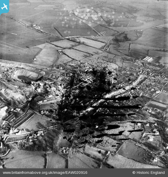
EAW020916 ENGLAND (1949). The town centre, Chipping Sodbury, 1949. This image has been produced from a damaged negative.
© Copyright OpenStreetMap contributors and licensed by the OpenStreetMap Foundation. 2025. Cartography is licensed as CC BY-SA.
Nearby Images (10)
Details
| Title | [EAW020916] The town centre, Chipping Sodbury, 1949. This image has been produced from a damaged negative. |
| Reference | EAW020916 |
| Date | 4-February-1949 |
| Link | |
| Place name | CHIPPING SODBURY |
| Parish | SODBURY |
| District | |
| Country | ENGLAND |
| Easting / Northing | 372659, 182401 |
| Longitude / Latitude | -2.3942685162312, 51.539367500266 |
| National Grid Reference | ST727824 |
Pins

Class31 |
Wednesday 8th of January 2014 04:26:23 PM |


![[EAW020916] The town centre, Chipping Sodbury, 1949. This image has been produced from a damaged negative.](http://britainfromabove.org.uk/sites/all/libraries/aerofilms-images/public/100x100/EAW/020/EAW020916.jpg)
![[EAW020915] The town centre, Chipping Sodbury, 1949](http://britainfromabove.org.uk/sites/all/libraries/aerofilms-images/public/100x100/EAW/020/EAW020915.jpg)
![[EAW020914] Barnhill Quarry and the town centre, Chipping Sodbury, 1949](http://britainfromabove.org.uk/sites/all/libraries/aerofilms-images/public/100x100/EAW/020/EAW020914.jpg)
![[EPW029278] St John the Baptist's Church and the High Street, Chipping Sodbury, 1929](http://britainfromabove.org.uk/sites/all/libraries/aerofilms-images/public/100x100/EPW/029/EPW029278.jpg)
![[EPW029280] The town centre, Chipping Sodbury, 1929](http://britainfromabove.org.uk/sites/all/libraries/aerofilms-images/public/100x100/EPW/029/EPW029280.jpg)
![[EPW024114] The town, Chipping Sodbury, 1928. This image has been produced from a print.](http://britainfromabove.org.uk/sites/all/libraries/aerofilms-images/public/100x100/EPW/024/EPW024114.jpg)
![[EPW029279] St John the Baptist's Church and the High Street, Chipping Sodbury, 1929](http://britainfromabove.org.uk/sites/all/libraries/aerofilms-images/public/100x100/EPW/029/EPW029279.jpg)
![[EPW029285] Barnhill Quarry, Chipping Sodbury, 1929](http://britainfromabove.org.uk/sites/all/libraries/aerofilms-images/public/100x100/EPW/029/EPW029285.jpg)
![[EPW029281] Broad Street and environs, Chipping Sodbury, 1929](http://britainfromabove.org.uk/sites/all/libraries/aerofilms-images/public/100x100/EPW/029/EPW029281.jpg)
![[EPW029284] The town and quarry, Chipping Sodbury, 1929](http://britainfromabove.org.uk/sites/all/libraries/aerofilms-images/public/100x100/EPW/029/EPW029284.jpg)