
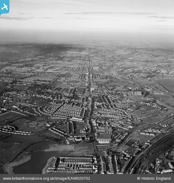
EAW020701 ENGLAND (1948). The Edgware Road running through Edgware and Stanmore, Hendon, from the south-east, 1948
© Copyright OpenStreetMap contributors and licensed by the OpenStreetMap Foundation. 2026. Cartography is licensed as CC BY-SA.
Nearby Images (20)
EAW020701

EAW020703

EAW020700

EPW021259

EAW043283

EAW020702

EPW029987

EAW043288

EPW029986

EAW043287

EAW043286

EAW043289

EAW043282

EAW020697

EPW032167

EPW032166

EPW029988

EPW030079

EPW029984

EPW029985

Details
| Title | [EAW020701] The Edgware Road running through Edgware and Stanmore, Hendon, from the south-east, 1948 |
| Reference | EAW020701 |
| Date | 17-December-1948 |
| Link | |
| Place name | HENDON |
| Parish | |
| District | |
| Country | ENGLAND |
| Easting / Northing | 521469, 188614 |
| Longitude / Latitude | -0.2466383315817, 51.582802998078 |
| National Grid Reference | TQ215886 |
Pins

Chrisandshe |
Tuesday 21st of July 2020 03:23:51 PM | |
|
Chrisandshe |
Tuesday 21st of July 2020 03:22:36 PM | |
|
Chrisandshe |
Tuesday 21st of July 2020 03:14:05 PM | |
|
Gefferz |
Sunday 16th of June 2019 09:52:25 AM | |

Class31 |
Wednesday 12th of March 2014 01:06:58 PM | |
|
Class31 |
Wednesday 12th of March 2014 01:06:16 PM |
