
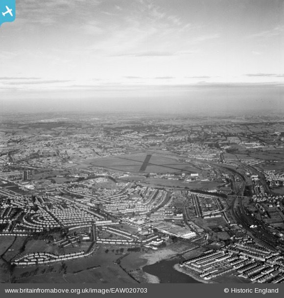
EAW020703 ENGLAND (1948). RAF Hendon and environs, Hendon, from the south, 1948
© Copyright OpenStreetMap contributors and licensed by the OpenStreetMap Foundation. 2026. Cartography is licensed as CC BY-SA.
Nearby Images (18)
EAW020703

EAW020701

EAW043283

EAW043288

EAW020697

EAW043282

EAW043287

EAW043286

EPW032167

EAW043289

EAW020702

EPW032166

EPW021259

EAW020700

EAW043284

EAW043285

EPW029987

EPW029986

Details
| Title | [EAW020703] RAF Hendon and environs, Hendon, from the south, 1948 |
| Reference | EAW020703 |
| Date | 17-December-1948 |
| Link | |
| Place name | HENDON |
| Parish | |
| District | |
| Country | ENGLAND |
| Easting / Northing | 521538, 188655 |
| Longitude / Latitude | -0.24562864822116, 51.583156633743 |
| National Grid Reference | TQ215887 |
Pins

Matt Aldred edob.mattaldred.com |
Thursday 7th of March 2024 10:31:00 AM | |
|
Matt Aldred edob.mattaldred.com |
Thursday 24th of August 2023 04:11:16 PM | |

robert |
Sunday 6th of January 2019 09:54:27 PM |