
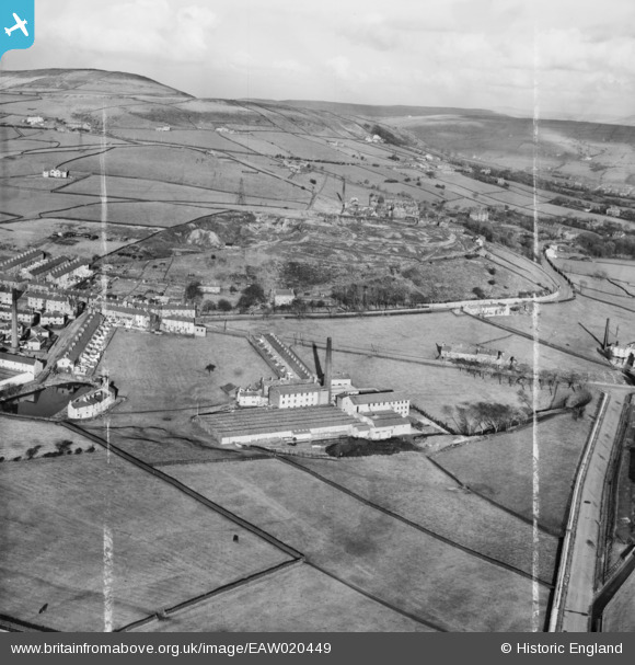
EAW020449 ENGLAND (1948). Syke Side Cotton Mill and environs, Haslingden, from the south-west, 1948. This image was marked by Aerofilms Ltd for photo editing.
© Copyright OpenStreetMap contributors and licensed by the OpenStreetMap Foundation. 2026. Cartography is licensed as CC BY-SA.
Nearby Images (7)
EAW020449

EAW020447

EAW020444

EAW020448

EAW020450

EAW020445

EAW020446

Details
| Title | [EAW020449] Syke Side Cotton Mill and environs, Haslingden, from the south-west, 1948. This image was marked by Aerofilms Ltd for photo editing. |
| Reference | EAW020449 |
| Date | 8-November-1948 |
| Link | |
| Place name | HASLINGDEN |
| Parish | |
| District | |
| Country | ENGLAND |
| Easting / Northing | 379165, 421970 |
| Longitude / Latitude | -2.3155690370053, 53.693531654451 |
| National Grid Reference | SD792220 |
