
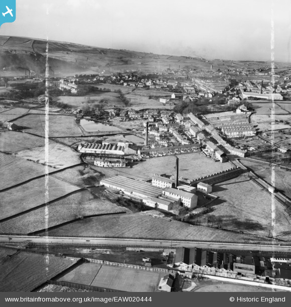
EAW020444 ENGLAND (1948). Syke Side Cotton Mill and environs, Haslingden, from the south-east, 1948. This image was marked by Aerofilms Ltd for photo editing.
© Copyright OpenStreetMap contributors and licensed by the OpenStreetMap Foundation. 2026. Cartography is licensed as CC BY-SA.
Nearby Images (7)
EAW020444

EAW020449

EAW020448

EAW020447

EAW020450

EAW020445

EAW020446

Details
| Title | [EAW020444] Syke Side Cotton Mill and environs, Haslingden, from the south-east, 1948. This image was marked by Aerofilms Ltd for photo editing. |
| Reference | EAW020444 |
| Date | 8-November-1948 |
| Link | |
| Place name | HASLINGDEN |
| Parish | |
| District | |
| Country | ENGLAND |
| Easting / Northing | 379204, 421974 |
| Longitude / Latitude | -2.3149786172495, 53.693569165148 |
| National Grid Reference | SD792220 |
Pins

wadey |
Saturday 10th of January 2026 04:23:14 PM | |
|
wadey |
Saturday 10th of January 2026 04:22:07 PM | |
|
wadey |
Saturday 10th of January 2026 04:21:00 PM | |
|
wadey |
Saturday 10th of January 2026 04:20:25 PM | |
|
wadey |
Monday 24th of November 2014 03:41:23 PM | |
|
wadey |
Monday 24th of November 2014 03:41:06 PM | |
|
wadey |
Monday 24th of November 2014 03:39:25 PM | |
|
wadey |
Monday 24th of November 2014 03:39:08 PM | |
|
granemill07 |
Wednesday 2nd of April 2014 10:15:04 PM | |
|
granemill07 |
Wednesday 2nd of April 2014 10:13:52 PM | |
|
granemill07 |
Wednesday 2nd of April 2014 10:13:22 PM | |
|
granemill07 |
Wednesday 2nd of April 2014 10:12:47 PM |