
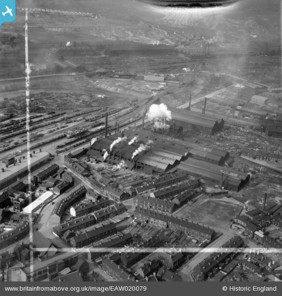
EAW020079 ENGLAND (1948). The English Steel Corporation Stevenson Road Works, Attercliffe, 1948. This image was marked by Aerofilms Ltd for photo editing.
© Copyright OpenStreetMap contributors and licensed by the OpenStreetMap Foundation. 2026. Cartography is licensed as CC BY-SA.
Nearby Images (21)
EAW020079

EAW018790

EAW020078

EAW018788

EAW020082

EAW018787

EAW020086

EAW018789

EAW018792

EAW020087

EAW020084

EAW018791

EAW020083

EAW040021

EAW040022

EAW020081

EAW020080

EAW020085

EAW040023

EAW040020

EAW040019

Details
| Title | [EAW020079] The English Steel Corporation Stevenson Road Works, Attercliffe, 1948. This image was marked by Aerofilms Ltd for photo editing. |
| Reference | EAW020079 |
| Date | 19-October-1948 |
| Link | |
| Place name | ATTERCLIFFE |
| Parish | |
| District | |
| Country | ENGLAND |
| Easting / Northing | 437509, 388784 |
| Longitude / Latitude | -1.4358757477504, 53.394292690218 |
| National Grid Reference | SK375888 |
